Contouring
Here we will know what is contouring in surveying. A contour or a contour line is an imaginary line which joins the point of equal elevation on the surface of the earth. For example, the periphery of the water surface of the still lake or pond represents the contour line.
What is contouring in surveying?
What is contouring in surveying? Contouring in surveying is the method of taking measurements in the field so that the contour lines can be drawn on a map. A contour map depicts the undulations in the form of contour lines to give a complete picture of the earth surface. Topography means the configuration of undulations of the earth surface. As contour maps shows the topography, they are also called topographic maps.
Contour Interval and Horizontal Equivalent
Contour interval is the difference in elevations between two successive contour lines in a contour map. The contour interval is selected based upon many factors like nature of ground surface and purpose of contouring.
Contour Interval = (RL of highest point – RL of lowest point) / (n + 1)
where, n = number of contours; RL = reduced level.
Characteristics of Contours
The contours have the following characteristics:
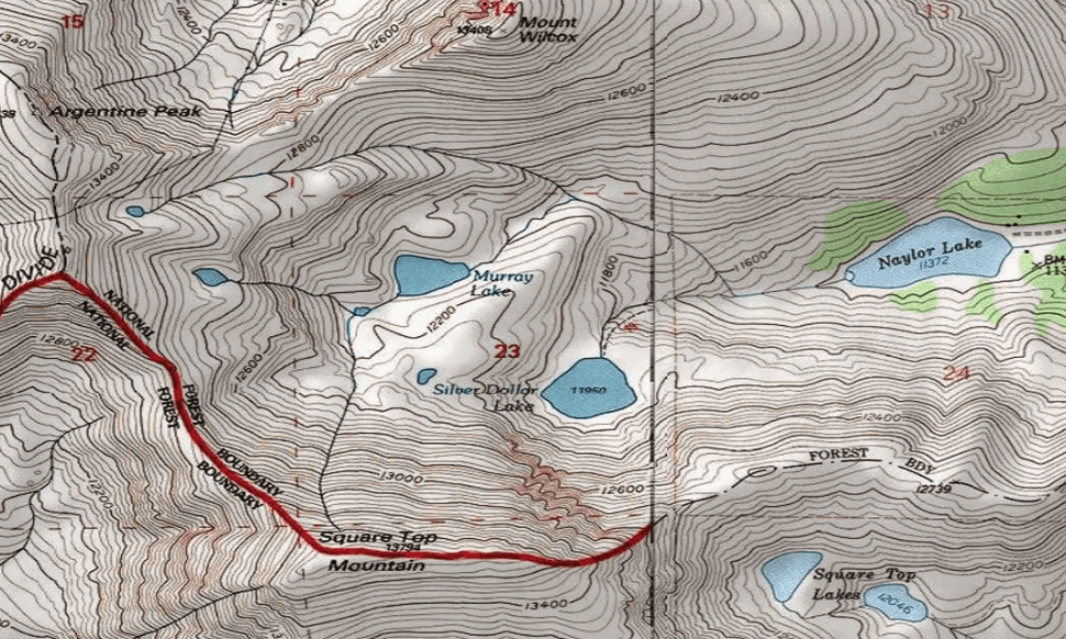
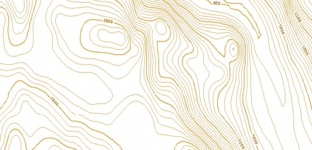
1. Contour lines are closed curves. They may close either of the map itself, or outside the map depending upon the topography.
2. The spacing between contour lines relies on the slope of the ground. The spacing is small for steep slopes and large for gentle slopes.
3. If contour lines are equally spaced, it indicates a uniform slope.
4. If the contour lines are straight, parallel and equally spaced, it indicates a plane surface.
5. The contours increase in elevation from inside to outside if there should be an occurrence of a depression. On the other hand, in case of a hill, the contours increase in elevation from outside to inside.
6. Contour line cross ridge line at right angles. The contours form U-shaped curves, with their concave side towards.
7. Contour lines cross a valley line at right angles. The contour lines form V-shaped curve with their convex side towards higher element.
8. Two contours of different elevations cannot intersect each other, as their point of intersection will have two different elevations, as mentioned against the contour lines. However in case of vertical and overhanging cliffs, the contours appear to cross each other.
9. Two contours of same elevations cannot unite and continue as a single contour. Similarly, a contour line cannot be split into two contours of same elevations.
So, here we came to know that what is contouring in surveying.
To know more about Contouring click here.